Huntley Area Maps 1953 – 2001
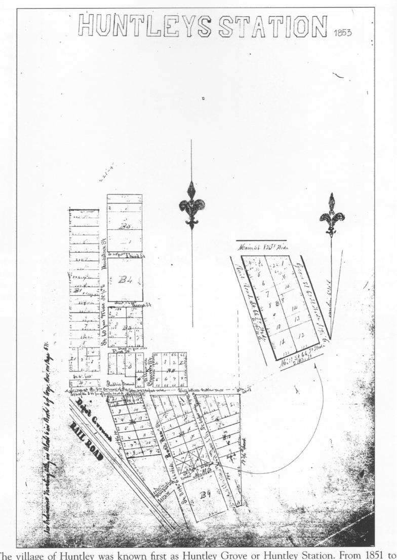
- Huntley Station 1853—This earliest map of Huntley Station was made two years after the first train came through the town, but before there was evidence of much development. Note that the present Church Street was originally named Railroad Street south of Main Street and there was no name given to the street leading south to the depot from Main Street.
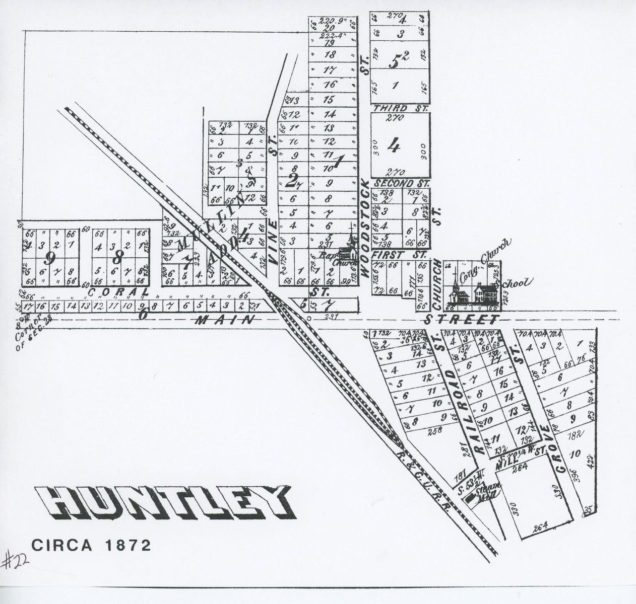
- Huntley 1872 Map – This map shows Coral Street platted for development west of the railroad tracks. While there was a minimal amount of commercial development in this location, it never materialized as extensively as indicated on the map. Note there are two churches pictured on the map, one a Baptist Church on Woodstock Street and the Congregational Church facing Main Street. Little is known about the short-lived Baptist Church. A two-story frame building served as the village school and was built over a two-year period, 1861-1862, just east of the Congregational Church.
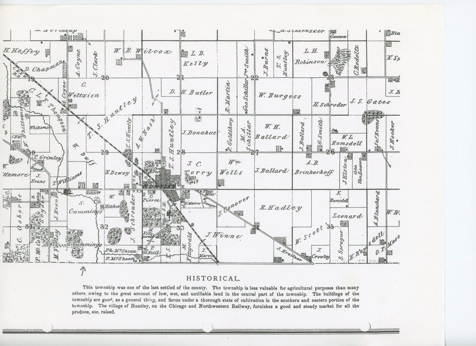
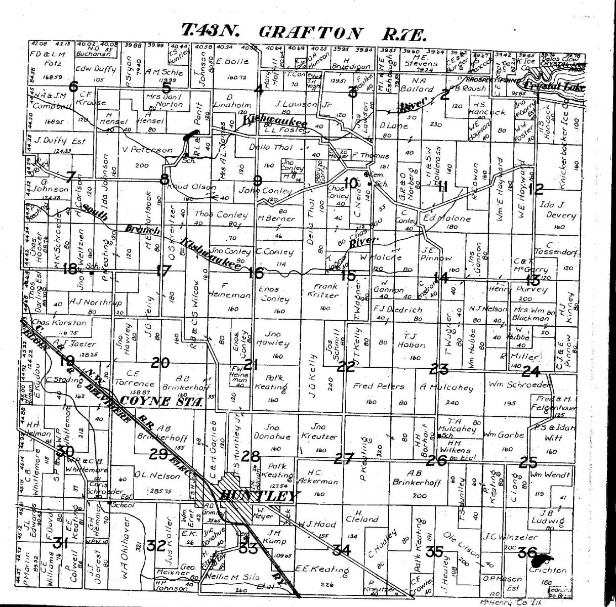
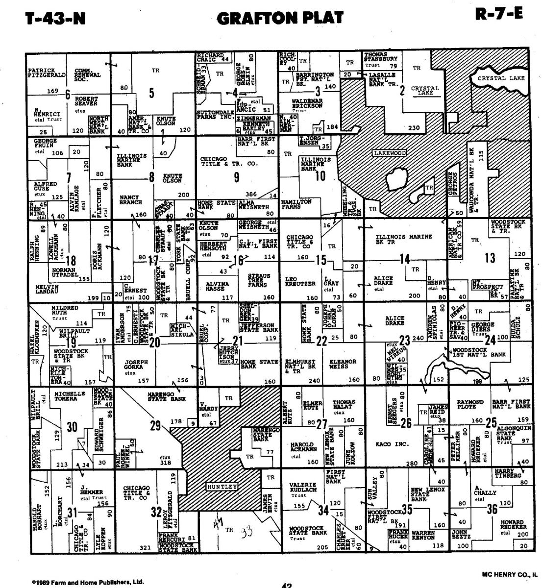
- Grafton Township 1872 – The township was one of the last settled in the county. Ownership of the land was well established by this time and many of these settlers were longtime residents of the community, providing stability for the area.

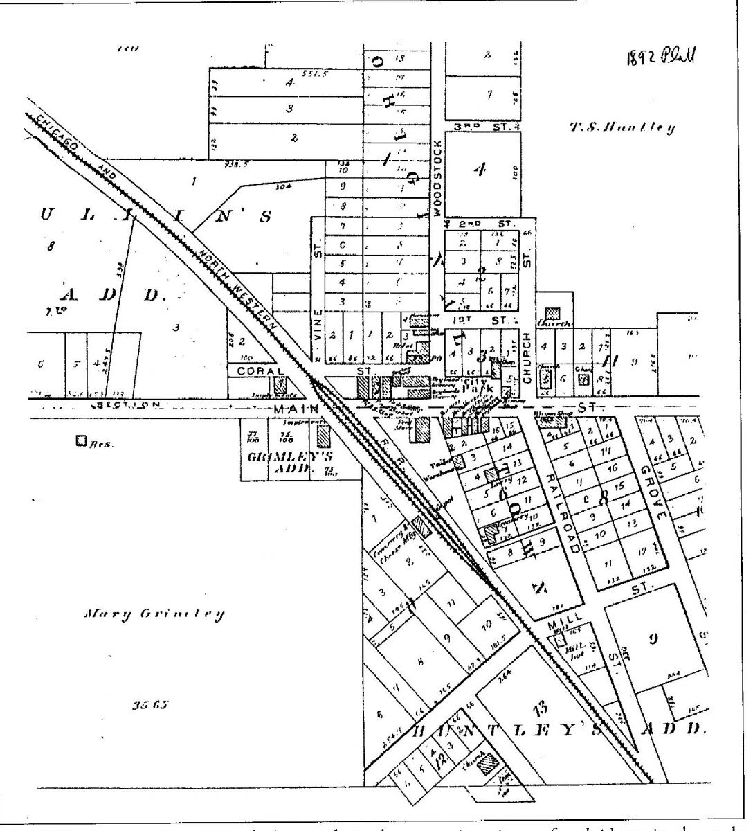
- Huntley Map 1892 – Note the extensive development in the 20 years since the previous map. East of the railroad tracks north of Main Street note the following businesses and churches: blacksmith shop, markets and shops, barbershop, two dry good and grocery stores, a hotel, a harness shop, a feed store, a meat market, shoe store and a wagon shop. South of Main Street were a feed store, a tailor, a warehouse, a livery, a creamery, a mill and a larger creamery on the west side of the tracks.

- Fire Map circa 1915 – This fire department map divided the town into sections with different numbers of whistles indicating in which section the fire was located. This notice was from a hand-written order from Fire Marshall Edward H. Cook.

- Huntley Sanborn Fire Map 1919 – These Sanborn maps were made for cities throughout the country for fire insurance purposes and detailed the various buildings and structures in the town. In Huntley, at the upper left of the map, a proposed Elgin Stove and Oven Company was to occupy the former Borden’s Milk plant. Proceeding along the railroad track to the southeast was the Squire Dingee Company, which was a pickle salting station. Proceeding south and east along the tracks was a Huntley Farmers’ Supply Company, which included a flour mill, coal bins and coal sheds. Note J. H. Patterson Lumber yard located on west Main Street. The company was in business at that location for more than 100 years. Notice the inset showing the area four blocks south of city hall as the location of St. Mary Church at that time. Coral Street was an important part of the downtown business district, even housing a motion picture facility. Hotel Huntley was at Main Street near the railroad tracks. Vine Street ends at Main Street. There was no Route 47 at this early date.

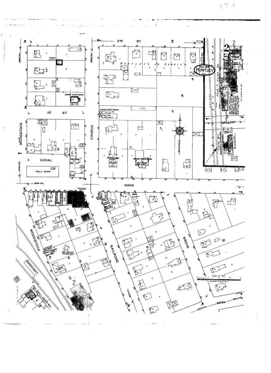
- Huntley Sanborn Fire Map 1919 #2 – This map shows the east side of downtown Huntley in November of 1919. The Evangelical Lutheran School was located at Church and First streets. Notice Coral Street makes a turn around the town park, and commercial buildings occupied the east end of the square. In years following, these buildings were removed, which allowed the park’s boundary to extend farther east. The city hall was located south of Main Street across from the depot, along the extension of Woodstock Street, later renamed Railroad Street. The firehouse and jail were in the same vicinity. The village water tower was situated behind the village hall. The inset at the right side of the map shows details of the interior of the John Jelke Milk Processing plant. South of Jelke’s plant is Victor Mey’s creamery, ice and electric plant. (Patrons wishing to view the fire maps in more detail can see them at the Huntley Area Public Library)

- Grafton Township c. 1925 – The Elgin-Belvidere Electric Interurban tracks are indicated here. Service was discontinued in 1930. The line paralleled the Chicago and North Western railroad tracks. In the early days, certain locations along the railroad were designated as milk-shipping stops and available to passengers as well. Note Coyne Station in large letters, indicating it was such a stop. Route 47 was not yet constructed at that time.

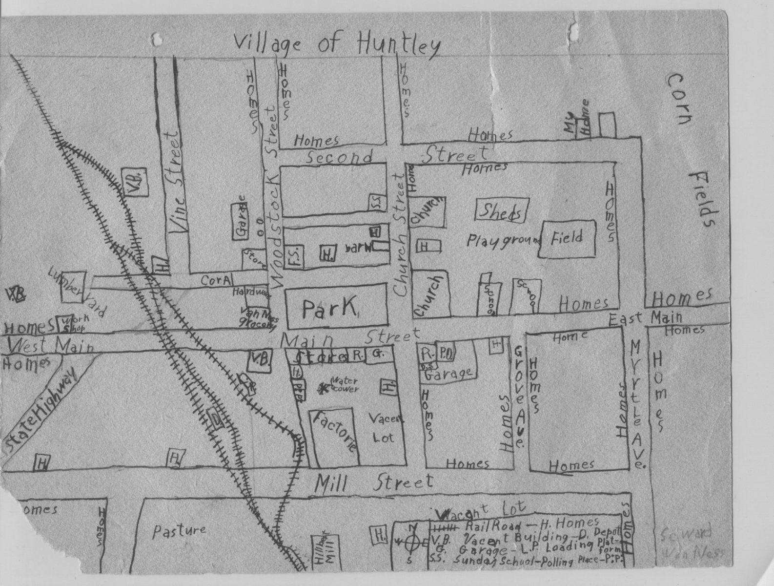
- Seward Van Ness c. 1935 – This hand-drawn map was made by Seward Van Ness as a grade school student in the early to mid 1930s. He indicates his home on Second Street and his father’s business on Woodstock Street. Notice Route 47 did not continue through Huntley at that time, indicating that the map is from before 1936 when the road was extended north of town.

- Grafton Township 1951 – Notice some of the country roads are now paved, although unnamed. Naming of rural roads in McHenry County began in the late 1960s. Prior to that time rural addresses were numbered mail routes for each community. The roads were named for long-time residents or early settlers along that way. The black and white markings indicate blacktopped roads.

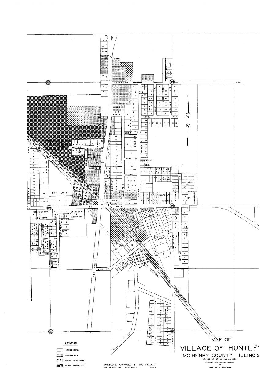
- Huntley Map 1962 — This map shows planned industrial, commercial and residential lots in the central village where little has changed. The proposed Hoy Avenue at the south of town has been named Frederick Way, and Grove Street today terminates at Martin Drive. The dark colored proposed industrial area in the northwest section of the village has evolved into light business development located along Wolf Drive off of the western extension of Algonquin Road. The Keating’s Addition to the west of Route 47 was developed, although Keating Avenue never was put through due to an additional block of housing.

- Village of Huntley circa 1980 – The McHenry County portion of the village is displayed here. Note where the elementary school and high school were located at this time. The Huntley Grade School was built in 1955 and housed both elementary and high school classrooms. The new high school opened at this location across Mill Street in 1968. Development along the north side of Kreutzer Road was on the increase.

- Grafton Landowners 1991 – Comparing this with earlier maps, there are fewer farmer-owners shown and more bank-owned properties. Only a handful of long-time owners from early settlement days remain.

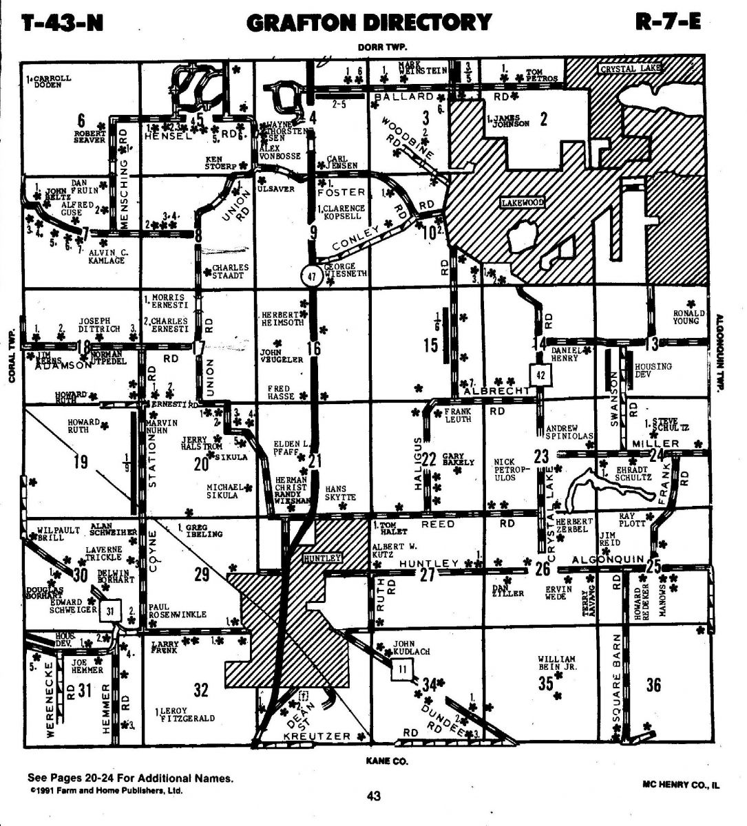
- Grafton Residents 1991 — Note that the roads have established names and those residing on the various properties are shown.

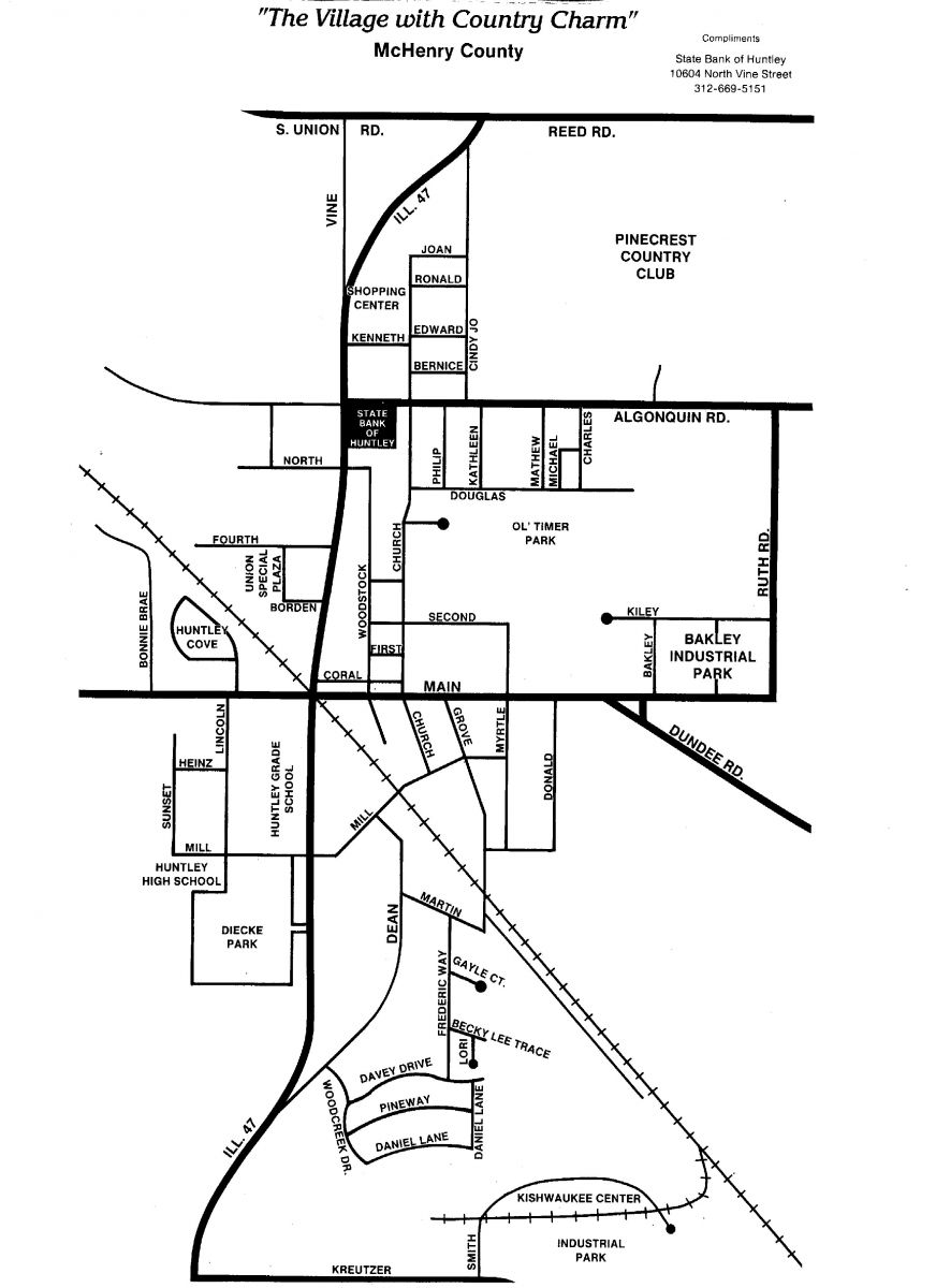
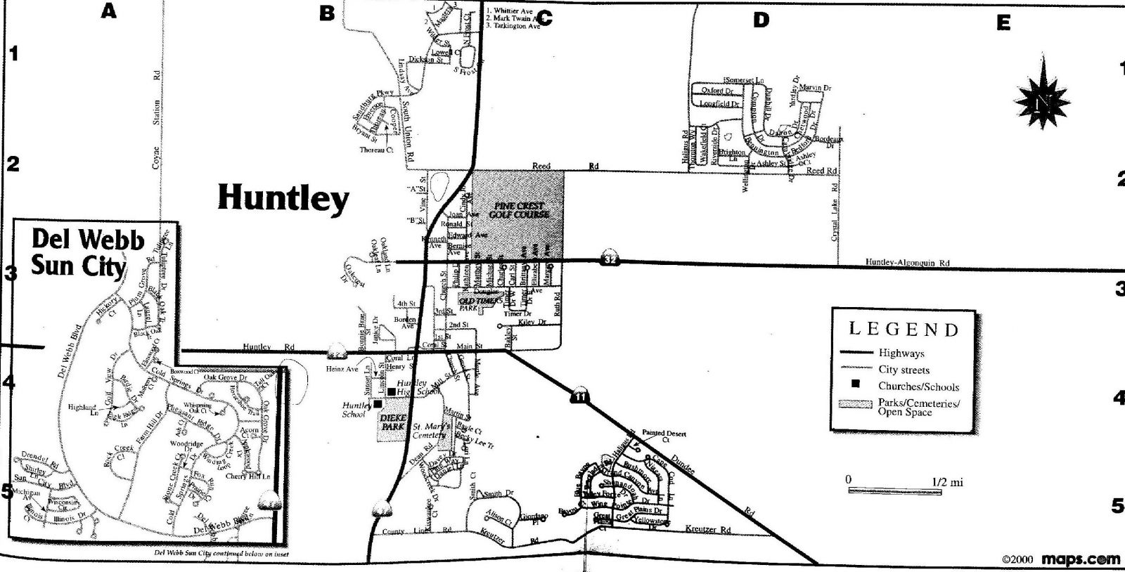
- Huntley 2001 – This map, from a Huntley phone book, shows the Del Webb community, which was first occupied in 1999. An error is made in the former location of the Huntley schools, with the elementary and high school positions being reversed. However, by this year, both schools in town were vacated and classes were held on the new Harmony Road Campus. North of Reed Road and west along Route 47, a proposed development with these street names never materialized. However, today the Talamore subdivision is in that general area.